The hiking trails of Honolulu allow you to see the island, its mountains and famous natural landmarks from above. You can even experience rainforest climates and spot a whale or two swimming in the ocean. The city of Honolulu on the Hawaiian island of Oahu may be a tropical urban paradise, but it’s surrounded by unique landscapes that are best explored on foot.
Whether you want to navigate a steep mountain ridgeline with the thrill of vertical drops, take a relaxing stroll through a shaded forest, or walk by the ocean to see Hawaii’s diverse marine wildlife, there’s a Honolulu hike that’s perfect for you.
- 1
Moanalua Valley Trail
The affectionately named Stairway to Heaven

- Adventure
- Budget
- Photo
The Moanalua Valley Trail takes you through a variety of sceneries, including a forest, a mountain ridge and the famous Haiku Stairs, commonly known as the Stairway to Heaven. It’s the only legal way to see the stairs, though climbing down them is prohibited. At the end of your journey, you’ll reach an abandoned radio tower that offers sweeping views over Honolulu and southern Oahu.
This 10.4-mile trip can take around 5 hours to complete, and with plenty of steep inclines and muddy pathways, it’s a popular hike with seasoned explorers. Remember that there is nowhere to refill your water during your walk, so pack plenty of refreshments.
Location: 1849 Ala Aolani St, Honolulu, HI 96819, USA
Open: Daily from 7 am to 7 pm
Map - 2
Kuliouou Ridge Trail
Forests, mountain ridgelines and stunning valley views

- Adventure
- Budget
- Couples
- Photo
The Kuliouou Ridge Trail provides amazing views over the Kuliouou Valley. You’ll first walk through an ironwood forest, where tall, thin trees give you some well-deserved shade. When you reach the ridgeline, you’ll ascend to the summit of the mountain, where you’ll be rewarded with the sights of East Oahu, the farmlands of Waimanalo, the Kailua coastline and the Koko Crater.
During your hike, you’ll navigate a series of switchbacks that zigzag up to the ridgeline. It’s a 5-mile trail that takes about 4 hours to complete at an easy pace. Remember to bring along plenty of water and some healthy snacks – you’ll need the energy.
Map - 3
Diamond Head Crater Hike
See the sights of Honolulu, the ocean and a volcano from above
- Adventure
- Photo
Read moreThe Diamond Head Crater Hike is a 560-ft ascent that starts from inside the crater itself. The trail may look challenging, but it usually only takes about an hour to reach the summit. When you arrive at the ridge, you can look into the crater from above and out towards the ocean, Waikiki beach and the city of Honolulu.
The trail is fully paved, though keep a lookout for potholes and loose gravel. As you ascend, you’ll climb narrow stairs and navigate old military tunnels and operation rooms built into the crater. Remember that although the trail closes at 6 pm, you won’t be permitted entry after 4.30 pm.
Location: Kapahulu, Honolulu, HI 96815, USA
Open: Thursday–Sunday from 6 am to 4 pm
Map - 4
Koko Crater Railway Trailhead
An abandoned railroad that leads to the top of an extinct volcano
- Adventure
- Budget
- Photo
Read moreKoko Crater Railway Trailhead is a remnant of what was constructed during WWII to transport soldiers and cargo. You can climb the more than 1,000 ‘stairs’ of the abandoned site for panoramic views over Port Lock Peninsula. As you ascend the steep incline, sights such as Hanauma Bay and Hawaii Kai slowly creep into view.
The Koko Crater Railway Trailhead is a challenging but popular hike that usually takes about an hour to complete. You may need to take plenty of breaks on your way, but you’ll be rewarded with breath-taking views of the Koko Head Crater and the east Honolulu shoreline when you reach the summit.
Location: 7604 Koko Head Park Rd #7602, Honolulu, HI 96825, USA
Open: Daily from 6.30 am to 11 pm
Map - 5
Hanauma Bay Ridge Hike
A waterside trail with hidden sandy beaches
- Adventure
- Budget
- Photo
Read moreThe Hanauma Bay Ridge Hike is just under 7 km, offering views of Koko Head Crater, Hanauma Bay and the beautiful rocky coastline. This moderate walk takes between an hour or 2 to tackle. If you have the time, there are plenty of places to take a break, including hidden beaches and diverse natural landscapes.
The Hanauma Bay Ridge Hike is suitable for people of just about any fitness level, but be aware that there is very little shade, so bring plenty of water, sunscreen and a hat. When you reach the rock bridge, you’ll get a glimpse of Hawaii Kai and Aina Haina, making it an excellent vantage point.
Location: 7381 Kalanianaʻole Hwy, Honolulu, HI 96825, USA
Map - 6
Makapu‘u Point Lighthouse Trail
A coastline hike to a famous vantage point
- Adventure
- Budget
- Families
- Photo
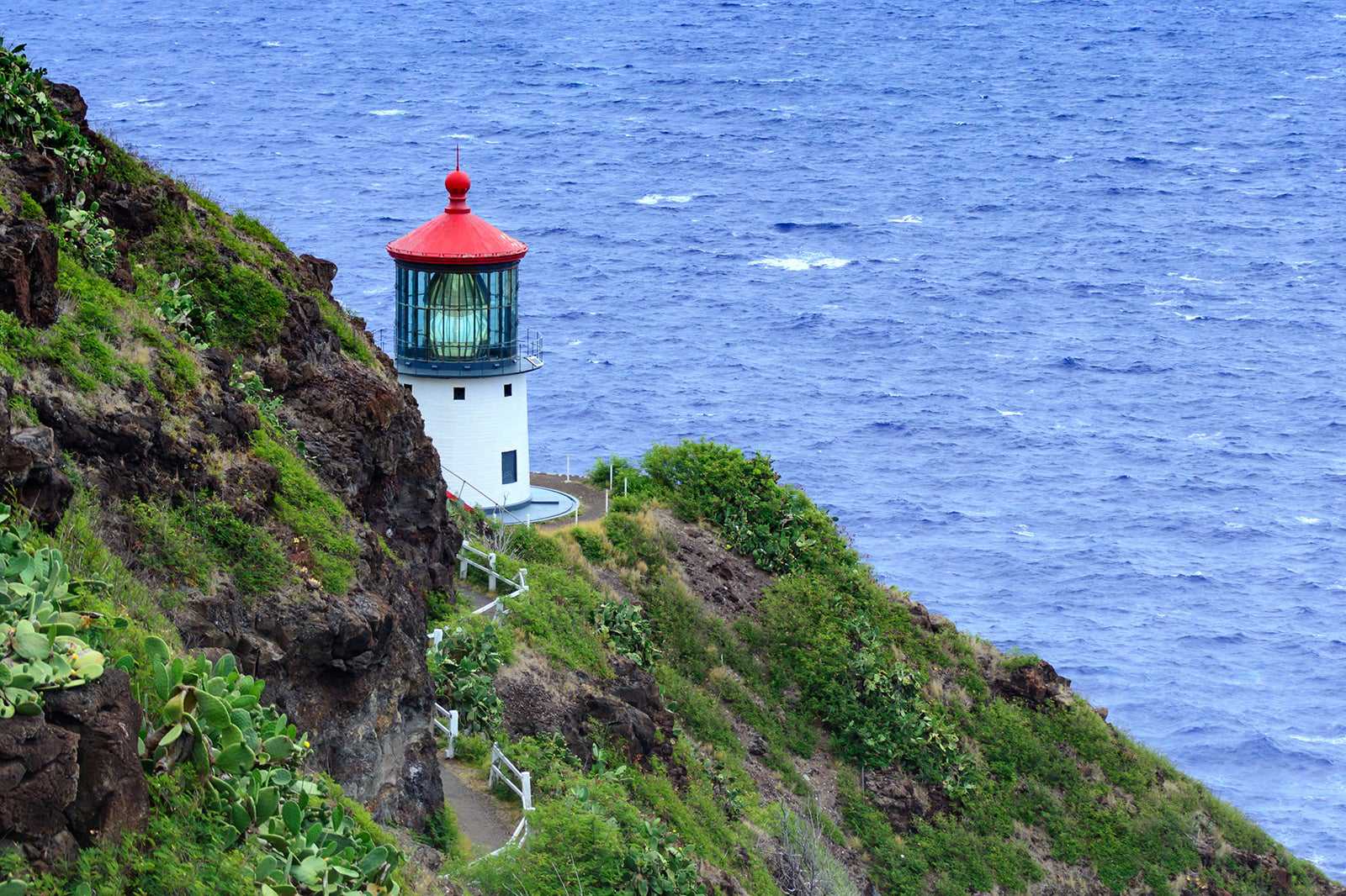
Read moreThe Makapu‘u Point Lighthouse Trail is a 2-mile hike that leads to Makapu‘u Head. During your trek, you’ll be able to see sights such as the Koko Crater and Oahu’s stunning south-eastern coastline. When you reach your destination, you can admire offshore islets, the windward coast and the red-roofed Makapu‘u Lighthouse, which was constructed in 1909.
Keep an eye out for Hawaiian seabirds like the tropicbird, frigatebird and ‘iwa (great frigatebird) when the islets come into view. For a spot of whale watching, hike the Makapu‘u Point Lighthouse Trail between November and May, but don’t forget to pack your binoculars.
Map - 7
Wiliwilinui Hiking Trail
A forest trail that leads to mysterious valleys
- Adventure
- Budget
- Photo
Read moreThe Wiliwilinui Hiking Trail is a 4.5-mile out and back hiking trail that takes you through dramatic landscapes backdropped by the sights of green, cloudy valleys and landmarks such as Kailua and Lanikai. On a clear day, you can admire views of the upmarket Aina Haina neighbourhood in East Oahu.
The Wiliwilinui Hiking Trail can be a workout for experienced hikers, but you can tackle most of the steep inclines using makeshift stairs built by previous hikers. We recommend arriving early to make sure you can snatch a parking space before the crowds arrive.
Map - 8
Manoa Falls Trail
A short hiking trail that leads to a stunning waterfall
- Adventure
- Budget
- Photo
Read moreThe Manoa Falls Trail gives you the chance to escape the bustle of Honolulu and experience one of Hawaii’s microclimates. The Manoa Valley is considered to be a rainforest, so don’t be surprised by drizzly weather conditions even when the urban climate is hot and dry. Expect to see plenty of lush greenery, native wildflowers and a couple of rainbows as you hike.
Thanks to the mysterious atmosphere of the Manoa Valley, the Manoa Falls Trail has been used as a filming location in Jurassic Park and the hit TV series Lost. At the trail’s end, there’s a 100-ft waterfall flowing down a dramatic rockface. The pool beneath the falls may look appealing, but swimming is prohibited.
Map - 9
Pali Puka Trail
The narrow ridgeline of the Ko'olau Mountains

- Adventure
- Budget
- Photo
The Pali Puka Trail is a steep ascent that follows the ridgeline of the Ko'olau Mountains to Pali Puka, a small ‘window’ in the rocks of a mountain face. Vertical drops and daring climbs make this trail popular with experienced hikers. When you reach the summit, you can enjoy a view that stretches from the windward coast to Kualoa.
The Pali Puka Trail is a 1.5-mile round trip. We recommend setting aside at least 2 hours to take on this challenging hike. Be cautious while navigating the narrow ridgeline – you can expect heavy winds at any time of the year.
Location: O‘ahu, Kaneohe, HI 96744, USA
Map - 10
Puu Maelieli Trail
A family-friendly hike overlooking Kane'ohe Bay

- Adventure
- Budget
- Families
- Photo
The Puu Maelieli Trail is a 2-hour hike that’s suitable for beginners. During most of your walk, you’ll be protected from the blazing sun by the shade of the trees, and there are plenty of vantage points that offer views over Kaneohe Bay. Reach the trail’s end, and you can see the entire Ko'olau Mountain Range from an old military pillbox.
The Puu Maelieli Trail is perfect for those who want to get started with hiking without having to contend with crowds. You’ll need to tackle a few steep inclines, but the views of K-Bay, the mountains and the windward coast make the effort well worth it.
Location: 279 Kahekili Hwy, Kaneohe, HI 96744, USA
Map


