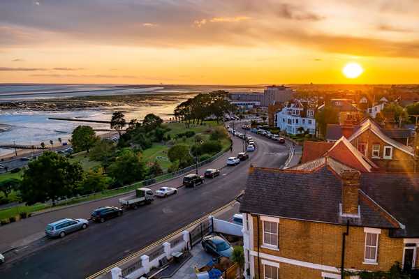
The 350-mile Essex coastline is second in length in England only to Cornwall’s. Known as the Discovery Coast, each stretch has its distinctive characteristics. Once, seafarers and smugglers considered the place their own. Today, you’ll see sun-seekers and stand-up paddleboarders, seals and seabirds, each drawn to their favourite spots.
Unsurprisingly, Essex has some beautiful sandy beaches, but that’s not all. Instead, the county mixes it up. Tidal flats and flower-strewn meadows cosy up to coastal inlets and streams. Wild and remote salt marsh fills every nook and cranny at the end of riverine estuaries. In these tucked-away spots, Essex feels like world’s end yet it’s close enough to welcome day-trippers from London.
- 1
Dovercourt Beach
See the iconic twin lighthouses

- ประหยัด
- ครอบครัว
- ประวัติศาสตร์
- ถ่ายรูป
Dovercourt Beach is one of just a handful in Essex to be awarded the coveted Blue Flag award. The sand-and-shingle beach shelves gently into the North Sea, while facilities such as a model yacht pond, skate park and boating lake ensure this is a family-friendly resort.
There are 2 iron-framed lighthouses, set about 200 yards apart, which were built in the 1860s. The photogenic structures, one on the beach and one in the water, are linked by a stone causeway that is submerged at high tide. Once, they helped steer ships safely into port at neighbouring Harwich, but became obsolete and were decommissioned over a century ago.
ที่ตั้ง: Dovercourt, Harwich CO12 3RJ, UK
แผนที่ - 2
The Naze Beach
Come to this North Essex beach for seal-spotting and fossil-hunting

- ผจญภัย
- ประหยัด
- ประวัติศาสตร์
- ถ่ายรูป
Walton-on-the-Naze has several beaches, but the one of most interest lies to the north of the town, close to Hamford Water, and is a popular destination for seal-watching trips. A significant coastal protection scheme was instigated there a few years ago, not least to protect the 18th-century brick lookout tower that stands on the greensward on the clifftop.
At sea level, sizeable granite boulders dissipate wave energy and help to protect the soft red crag cliffs from further erosion. Ramble along the beach to scout the beach for ancient sharks’ teeth and pyritised twigs once concealed in the underlying London clay.
ที่ตั้ง: Walton-on-the-Naze, UK
แผนที่ภาพโดย Alex Liivet (CC BY 2.0) เวอร์ชั่นแก้ไข
- 3
Frinton Beach
Step back in time at this charming coast

- ผจญภัย
- ถ่ายรูป
It’s easy to imagine how Frinton would have been in its 1920s and 1930s heyday. Tree-lined avenues lead to Modernist Art Deco properties designed by Oliver Hill and a broad, grassy greensward overlooked by grand houses. Cliff paths slope down to a beautiful sandy beach backed by impeccably maintained beach huts.
You’ll still hear people speak of how life is better “within the gates”, though those gates now have a new home in the railway gardens after residents protested at their removal by Network Rail a decade ago. This is a resort that does things a little differently: the first fish and chip shop didn’t open until 1992 and you wouldn’t have seen a pub before 2000.
ที่ตั้ง: 17-18 Esplanade, Frinton-on-Sea, UK
แผนที่ภาพโดย Aoshi_88 (CC BY-SA 2.0) เวอร์ชั่นแก้ไข
- 4
Clacton-on-Sea
Unapologetic Clacton is brash, busy and blessed with great beaches

- ผจญภัย
- ประหยัด
- ครอบครัว
- ถ่ายรูป
Clacton-on-Sea is a take-me-as-you-find-me resort that won’t put on airs and graces for any visitor. Instead, what you’ll find is good, honest fun: a busy pier with funfair rides for the kids and manicured cliff-top gardens for their grannies and grandpas. Quieter Holland-on-Sea to the north and the grassy dunes of Jaywick beach to the south complete the picture.
Over 1,600 hours of sun each year give rise to the area’s well-deserved nickname: the Sunshine Coast. Sunbathers will be pleased to learn that these beaches enjoy some of the driest weather in the UK, while the North Sea wind puts a smile on the faces of the many windsurfers and kiteboarders who come here.
ที่ตั้ง: Marine Parade E & W, Clacton-on-Sea, UK
แผนที่ - 5
Shoebury East Beach
Travel east from Southend for this family favourite

- ผจญภัย
- ประหยัด
- ครอบครัว
- ถ่ายรูป
Shoeburyness’ East Beach has a wide swath of sand and shingle backed by low grassy dunes and reliable onshore breezes that make it ideal for those who love kitesurfing. In fact, it’s the base of the Essex Kitesurfing Club. The excellent water quality at this Blue Flag site, picnic benches and beach huts for hire make the place a family favourite too.
On a clear day, the Shivering Sands Army Fort can be seen in the distance across the water. This group of Maunsell Forts was built as anti-aircraft defences in World War II, constructed on land and floated out into the Thames Estuary. The remnants of a unique Cold War-era boom is a further reminder of the military influence that shaped this part of Essex coast.
ที่ตั้ง: 13A Rampart Terrace, Southend-on-Sea SS3 9AE, UK
แผนที่ - 6
Southend-on-Sea
Eat cockles and ride the pier train

- ผจญภัย
- ครอบครัว
- ประวัติศาสตร์
- ถ่ายรูป
Southend’s long history as a seaside resort began over 200 years ago; following Princess Caroline’s visit in 1803, fashionable society couldn’t get enough of the place. But it took the coming of the railway in the 1850s to cement Southend’s appeal. In the first half of the 19th century, it was a favoured day trip destination for East London’s working class. They’d have combined a paddle in the shallows with a plate of cockles or a Rossi ice cream, just as today’s visitors do.
An injection of cash has revitalised the seafront. Jubilee Beach, backed by kid-friendly fountains and upgraded street furniture, is handy for Southend’s famous pier, the Sea Life aquarium and Adventure Island’s many rides. Nearby Three Shells Beach is noteworthy as a recipient of a Blue Flag, as is Thorpe Bay, further east beyond the Kursaal, which also has some of the best beach huts in town.
ที่ตั้ง: 37 Marine Parade, Southend-on-Sea SS1 2EL, UK
แผนที่ภาพโดย Brian Snelson (CC BY 2.0) เวอร์ชั่นแก้ไข
- 7
West Mersea Beach
Head to an island that has its eyes firmly fixed on the water

- ผจญภัย
- ครอบครัว
- อาหาร
- ถ่ายรูป
You’ll find West Mersea Beach on the UK’s most easterly – and 7th-largest – island, reached via a tidal causeway known as the Strood. Oystermen have been plying their trade here for 2,000 years and fishermen land their catch here daily, to be sold not only in the nearby pubs and cafés but also to some of London’s top hotels and restaurants.
Watersports enthusiasts are equally thick on the ground. Boat trips on the Lady Grace focus on serene sunsets and abundant nature. Crabbing from the jetty keeps the little ones amused and novices of all ages can safely try paddleboarding, kayaking and windsurfing on the calm waters. Sailing yachts take centre stage during the August Regatta, which features a round-the-island race.
ที่ตั้ง: 401 Victoria Esplanade, West Mersea, Colchester CO5 8AT, UK
แผนที่ภาพโดย kitmasterbloke (CC BY 2.0) เวอร์ชั่นแก้ไข
- 8
Brightlingsea Beach
Visit an Essex resort whose history ties it to Sandwich in Kent

- ประหยัด
- ครอบครัว
- ประวัติศาสตร์
- ถ่ายรูป
Brightlingsea is a popular resort with an open-air lido and a string of colourful beach huts that line the sandy beach. It's unique in that it is the only port north of the Thames to be associated with the Cinque Ports. In the Middle Ages, these supplied ships to the king in return for certain privileges such as exemption from taxation.
Sandwich in Kent adopted Brightlingsea in the 14th century as what’s known as a limb to ensure it could meet its quota. Its oysters were also a deal sweetener. For that reason, the Essex resort still pays Sandwich a ceremonial fee of 50 pence a year on Choosing Day, held on the first Monday of December.
ที่ตั้ง: Brightlingsea, Colchester CO7 0HH, UK
แผนที่ - 9
RSPB Old Hall Marshes
Enjoy the tranquillity and beauty of Essex’s wild salt marsh

- ผจญภัย
- ประหยัด
- ถ่ายรูป
Old Hall Marshes form part of the Blackwater Estuary National Nature Reserve, a sprawling Site of Special Scientific Interest close to the villages of Tollesbury and Tolleshunt D’Arcy. This Royal Society for the Protection of Birds (RSPB) site consists of brackish water fleets, reed-lined water channels, saltmarshes and 2 offshore islands.
Birdwatchers delight in the range of native and migratory species here such as Brent geese, avocets, marsh harriers and oystercatchers, bringing long lenses to record their sightings. Walkers keen to feel a breeze on their cheeks come too, yet it’s not hard to find space for quiet reflection in this remote place.
ที่ตั้ง: Old Hall Lane, Tolleshunt D'Arcy, Maldon CM9 8TP, UK
แผนที่ภาพโดย Sludge G (CC BY-SA 2.0) เวอร์ชั่นแก้ไข
- 10
RSPB Wallasea Island
Discover a tidal marshland rich in birdlife

- ผจญภัย
- ประหยัด
- ถ่ายรูป
Wallasea Island was once not 1 but 5 separate islands. Over time, farmers enclosed these areas of saltmarsh with sea defences and drained them for agricultural land. Nearby Paglesham was a notorious haunt of smugglers who hid their loot in the marshes until it was safe to retrieve it.
Today’s Royal Society for the Protection of Birds (RSPB) Wallasea Island site forms part of the Wild Coast Project, which is returning the land to its original state. Ironically, it was an urban engineering project, London’s Crossrail, which provided the clay, chalk and gravel needed while sea wall breaches did the rest. As at nearby Lion Creek, walkers will relish the sight of halophytic plants and abundant birdlife in a peaceful setting.
ที่ตั้ง: Creeksea Ferry Road, Rochford SS4 2HD, UK
แผนที่

